Türkiye’s New Axes | #16 THE ÇEŞMELİ–KIZKALESİ MOTORWAY AND EFFECTIVE ACCESS FOR MERSİN REAL ESTATE
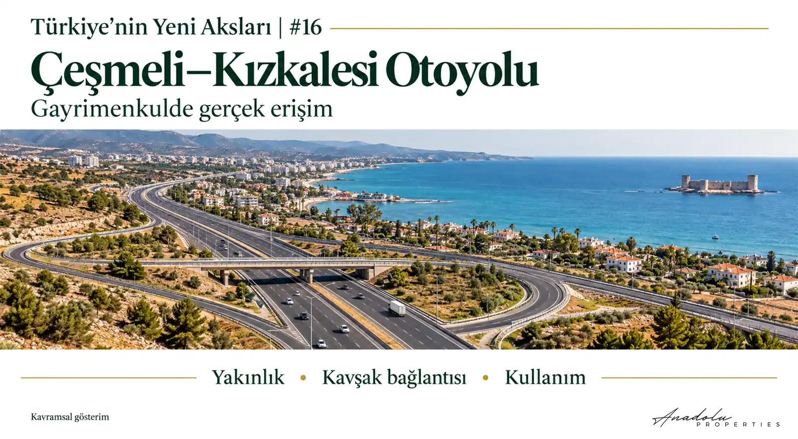
From a Motorway Opening to a Property’s Economic Access
The opening of the Çeşmeli–Kızkalesi Motorway has created a new transport option along Mersin’s western coast. For real estate, the decisive question is which properties experience changes in use, accessibility and economic activity as a result. Proximity to a motorway does not mean easy access to a usable entrance or the acquisition of new development rights.
At Anadolu Properties, we examine this distinction through the “Interchange Impact Filter”. A motorway may pass alongside a property, yet reaching its entrance may require a long journey on local roads. Another property that appears further away may be more functional because of its suitable connection. This is why we investigate transport investment at parcel level.
The Section Opened on the Çeşmeli–Kızkalesi Motorway
On 17 October 2026, the Ministry of Transport and Infrastructure announced that construction was complete and the road would open to traffic at 00:01 on 19 October. Anadolu Agency’s report dated 19 October confirmed that drivers had begun using it. Opening to traffic and the official inauguration announced for a later date are separate events. Source: Anadolu Agency, 19 October 2026.
According to the Ministry’s statement of 17 October, the 52 kilometres opened comprise 41 kilometres of main motorway and 11 kilometres of connecting roads. The same statement lists seven tunnels, five viaducts, ten grade-separated interchanges, two motorway service facilities and six toll collection areas. The total length should not be read as consisting entirely of the main motorway. Source: Ministry of Transport and Infrastructure, 17 October 2026.
The commissioning of the Çeşmeli–Kızkalesi section does not mean that the entire Çeşmeli–Erdemli–Silifke–Taşucu project is complete. The Ministry’s statement of 27 September 2026 identifies the Kızkalesi–Taşucu extension as the next stage and aims to strengthen Taşucu Port’s access to the main road network once that section is completed. We do not treat this objective as an existing connection. Source: Ministry of Transport and Infrastructure, 27 September 2026.
The road entering service is a concrete development. Assessing its traffic impact requires actual vehicle counts and route choices; assessing its real estate impact requires completed sales and lettings. The opening alone is not evidence of appreciation.
The D400 and the New Transport Pattern on Mersin’s Western Coast
Residential settlements, tourism, agriculture and commerce coexist along the coastline extending west from Mersin. Towards Erdemli and Kızkalesi, the D400 serves local businesses, tourism facilities and everyday travel as well as intercity traffic. In summer, these different movements can converge on the same road.
According to the General Directorate of Highways’ route description, the new section starts at the Çeşmeli Interchange on the existing Mersin–Adana–Gaziantep Motorway. It runs parallel to the D400 north of the settlements of Erdemli and Kızkalesi, connecting to the D400 through the Kızkalesi Interchange. Source: General Directorate of Highways, Çeşmeli–Kızkalesi project page.
Some long-distance traffic moving onto the motorway and changes in properties’ economic use are different processes. Reduced congestion on the coastal road may help some users. Conversely, businesses that attract customers from passing vehicles may see their existing traffic flows change. We therefore do not assume that the new road will affect every property in the same direction.
How to Interpret Travel Time and Savings Projections
The Ministry’s statement of 17 October 2026 projects a reduction in journeys that can take up to 2.5 hours in summer to 18 minutes. It also cites annual time savings of TRY 2.68 billion, fuel savings of TRY 340 million and a reduction of 17,000 tonnes in carbon emissions. These are project forecasts, not realised annual results. Source: Ministry of Transport and Infrastructure, 17 October 2026.
The 2.5-hour figure refers to congested summer conditions; it cannot be used as the starting travel time for every journey throughout the year. Nor is 18 minutes a door-to-door travel time from every neighbourhood to every tourism facility. Access to the interchange and the final connecting road may alter a property’s actual journey time.
Tolls also influence route decisions on a tolled motorway. One driver may prioritise time savings while another chooses the D400 because of cost. To understand the economic impact, we must examine the announced travel performance alongside users’ actual choices.
Real Estate Impacts Around Erdemli and Kızkalesi
Commerce and Everyday Travel in the Erdemli Area
The diversion of some through traffic from the coastal road may change the relationship between everyday travel and intercity movement in Erdemli. However, a shop’s value does not depend solely on the number of vehicles passing it. Pedestrian activity, customer profile, parking, visibility, the surrounding population and the capacity to pay rent also matter. We therefore do not equate the motorway opening directly with higher commercial rents.
Access and Tourism Demand in the Kızkalesi Area
More predictable travel to Kızkalesi may matter for accommodation businesses. To assess how far this convenience translates into demand, overnight stays, season length, occupancy, average room revenue, day-visitor activity and travel costs must be monitored. Without these data, no specific rate of appreciation can be claimed for hotels, guesthouses or tourism development land.
Land-Use Rights North of the Motorway
The route passing north of the coastal settlements does not mean that all nearby land has the same permitted uses. Agricultural land, existing settlements and planned development areas may be subject to different legal conditions. A motorway passing nearby does not demonstrate that land has been designated for residential, commercial or tourism development.
A Five-Stage Review Using the Interchange Impact Filter
In this instalment of Türkiye’s New Axes, we define the Interchange Impact Filter as an assessment method for investigating whether the new motorway changes a particular property’s economic use. Effective connection access, land-use rights, travel costs, traffic movement and observed market demand are examined together. This framework is neither a calculated investment score nor a coefficient of appreciation.
1 Effective Connection Access
We start with the straight-line distance and examine how the nearest usable entrance or exit is reached by road. Local road standards, circuitous connections and actual road distance are decisive. On a controlled-access road, the shortest line between a property and the motorway does not constitute a usable connection.
2 Legal Suitability of Use
Which uses does the current zoning plan permit? Is the property in an agricultural, tourism, residential or commercial area, and what development conditions apply? We assess transport advantages alongside legal land-use rights. The road’s opening may not have changed existing rights.
3 Total Travel Cost
Tolls, fuel, vehicle type, the last-mile connection and frequency of use affect total cost. Particularly in commercial transport, the fastest route may differ from the economically preferable one. We examine time savings alongside these conditions.
4 The Direction of Economic Movement
It is necessary to monitor which roads vehicles choose, which settlements see less traffic and which interchanges attract new movement. Without distinguishing businesses that benefit from this change from those whose existing customer flows change, we cannot claim that every commercial property gains an advantage.
5 Observed Market Impact
Actual sale prices and lease agreements, new businesses, tourism facility performance and building permits should be examined. Whether the observed change stems from the motorway or other economic conditions must also be investigated. We attach particular importance to this final filter to distinguish potential from realised economic value.
Comparing 300 Metres of Proximity with 5 Kilometres of Access
Consider two entirely hypothetical properties. Property A is 300 metres from the motorway in a straight line, but reaching the nearest usable connection requires travelling 12 kilometres on local roads. Property B is four kilometres from the motorway in a straight line, yet can reach a motorway entrance via a suitable road in five kilometres.
In terms of actual road distance, B may be more functional. The assessment changes if zoning status and intended use differ. These figures are not measurements or valuations of real parcels; they illustrate the method. Proximity does not establish easy access, and easy access does not necessarily establish appreciation.
Planning and Protection Conditions on Mersin’s Coast
In coastal areas, Coastal Law No. 3621 and its implementing legislation must be considered. The legally defined coastal boundary, coastal strip and development conditions are examined separately when assessing a parcel’s use. Improved transport does not remove this protection framework. Source: Coastal Law No. 3621, Ministry of Justice legislation system.
For the non-agricultural use of agricultural land, procedures under the Soil Conservation and Land Use Law No. 5403 also matter. Proximity to a motorway does not replace the necessary planning decisions and permissions. Source: Ministry of Agriculture and Forestry, Agricultural Land Assessment Unit.
Current zoning plans, agricultural protection status, coastal legislation, any heritage or conservation designations, ownership and expropriation records should be examined together for each property. Transport infrastructure and development rights are separate legal and economic matters.
Market Indicators for Anadolu Properties to Monitor
We first identify the section in service and its entry and exit connections. We then examine access to existing settlements, the property’s land-use rights and its economic activity. Within this framework, we investigate whether the new transport pattern is reflected in market activity.
More predictable travel times along Mersin’s coast, redistribution of D400 traffic and differences between particular interchanges in terms of economic access are possible effects. Each must be tested against data; none can be presented as realised real estate appreciation.
During the initial operating period, regular traffic counts, motorway usage rates, changes on the D400, tourism business performance and completed real estate transactions should be monitored together. While a property becomes easier to reach, the existing customer movement it benefits from may change in a different direction.
The series’ Access Time Premium approach examined the economic significance of changes in journey time. The Interchange Impact Filter examines whether that change reaches a particular property. This preserves the distinction between shorter regional travel times and benefits at parcel level.
Looking for the New Road’s Value in Property Use
The Çeşmeli–Kızkalesi section, opened on 19 October 2026, created a concrete transport change on Mersin’s western coast. Which properties experience economic consequences, to what extent and in which direction must be measured separately. We do not equate infrastructure completion with the realisation of economic effects.
Ease of access may be central for a hotel, customer movement for a roadside business, land-use rights for agricultural land, and connecting roads and transport costs for a warehouse. The weight assigned to each factor changes with the property’s function. The question is not only “How many metres is it from the motorway?” but also “Can this property actually access the economic opportunities offered by the new road?”
This study has been prepared for general information and research purposes. The announced journey times and savings figures are official project forecasts, not realised outcomes for all users. Motorway proximity does not guarantee appreciation or new development rights. Zoning, ownership, expropriation, agricultural and coastal protection status, actual access distance and market conditions must be examined separately for each property.
Mustafa Yılmaz
CEO – Anadolu Properties
Europe–Türkiye Investment Bridge